Quantification of Spatial Change in Natural Areas Within the Niagara Peninsula
The Niagara Peninsula Conservation Authority (NPCA) was established on April 30th 1959 under the Conservation Authorities Act. The NPCA serves roughly half a million people in a jurisdiction known as the Niagara Peninsula Watershed. When established the driving force behind the conservation movement was the organizations grassroots programs surrounding land stewardship and water quality and protection. Now, the Niagara Peninsula Conservation Authority’s commitment to these grassroots programs is vital as it strives to manage the impacts of human activities, urban sprawl, habitat destruction and rural activities within its jurisdiction.
The Client -> Niagara Peninsula Conservation Authority
The legislative mandate of the Conservation Authority, as set out in Section 20 of The Conservation Authorities Act, is to establish and undertake programs designed to further the conservation, restoration, development and management of natural resources. The NPCA fulfills this mandate by advocating and implementing programs that:
-
Improve the quality of lands and waters within its jurisdiction
-
Contribute to public safety from flooding and erosion
-
Provide for the acquisition of conservation and hazard lands
-
Enhance the quality of life in its watershed by using its lands for regional recreation, heritage preservation and conservation education
Mandate
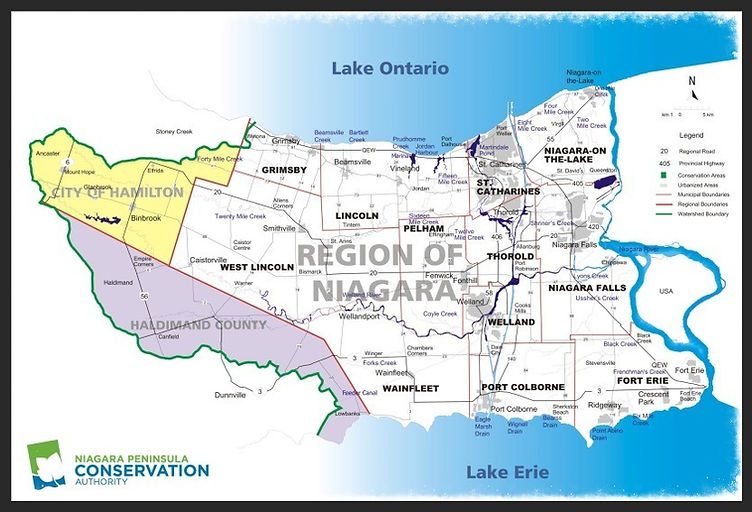
NPCA Watershed
the Niagara Peninsula Conservation authority oversees a jurisdiction that serves roughly half a million people. This jurisdiction, known as the NPCA watershed will be the location of AML Spatial Solutions’ study area. The Study area encompasses all of the Niagara Region, the southeast corner of the city of Hamilton and the Northeast portion of Haldimad County. The jurisdiction is broken up into sub watersheds which are based on the region’s major bodies of water. The NPCA watershed and its Subwatershed can be seen in Figure 2 below.